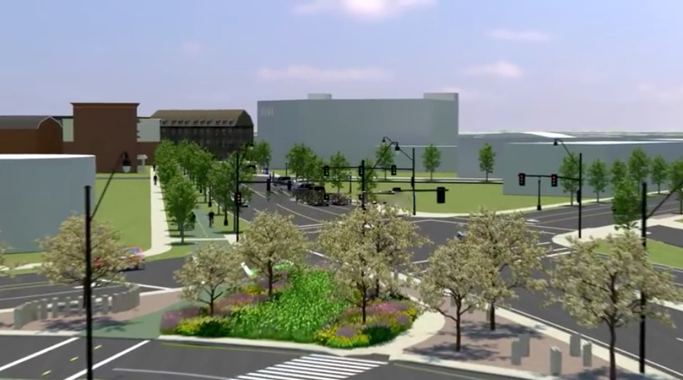
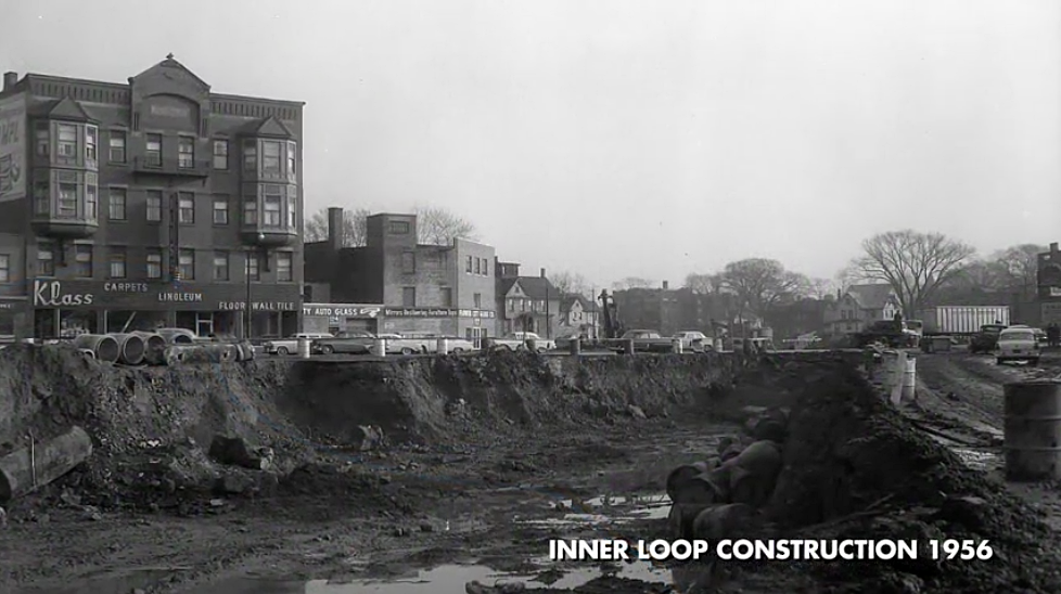
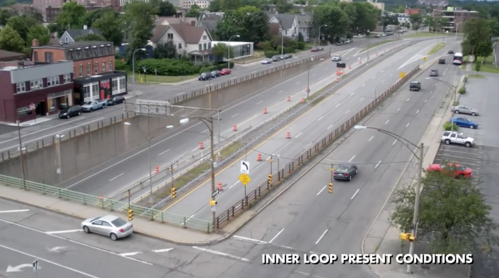
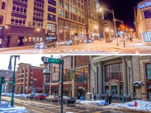
Each week between now and March 21, Smart Growth America is profiling one winning example of its 2018 Best Complete Streets Initiatives. First up is Rochester, NY’s Inner Loop East Transformation Project: “Through the Inner Loop East Transformation Project, the City of Rochester, NY is reimagining its street network by putting people and place before cars,” reports Heather Zaccaro. “Thanks to a federal TIGER grant and broad support from the community, Rochester is converting an outdated urban expressway into a walkable, bikeable Complete Streets boulevard. The project reconnects the neighborhoods once divided by the expressway and works toward achieving the goals set forth in the city’s Complete Streets ordinance and Master Plan.” “The Inner Loop East Transformation Project is the culmination of a broader Complete Streets initiative in Rochester, NY. The city formally established its commitment to Complete Streets in 2011 by adopting a Complete Streets ordinance. The ordinance pledged to ‘create an interconnected network of transportation facilities which accommodate all modes of travel.’ Three years later, the city revised its Center City Master Plan to support this commitment to Complete Streets, re-envisioning downtown Rochester as ‘an urban community of lively streets and public spaces that provided a desirable place to live and work…'” “Like many cities around the country, Rochester experienced rapid, sprawling growth in the aftermath of World War II. Suburbanization created new travel patterns with an increasing number of commuters driving into and out of the downtown core. In an effort to mitigate congestion, the city carved a series of trenches through its downtown. This ring of sunken bypasses formed the Inner Loop, a project that was hailed as innovative at the time. Unfortunately, like most urban highway systems, the Inner Loop ultimately stifled downtown development, disconnected neighborhoods, and made it more difficult for people to walk, bike, and ride public transit into downtown.” “To create better street connectivity downtown and create new opportunities for development and active transportation, Rochester is filling in a 4,500-foot stretch of the Inner Loop to create a new Complete Streets boulevard at street level… In addition to filling in a portion of the six-lane sunken expressway, the project also converts the existing surface-level streets that run alongside the Inner Loop into green space and land for redevelopment. In all, the city is eliminating 12 lanes of roadway designed exclusively for high-speed traffic, freeing up 5.7 acres of land for mixed-use development along a new, walkable boulevard. The redesigned corridor includes landscaping, protected cycle tracks, wide sidewalks, and frequent crosswalks. This design also reconnects nearby residential neighborhoods to the East End, a vibrant downtown district, by restoring the portions of the street grid formerly blocked off by the Inner Loop.” “As a result of this transformation, Rochester expects to see many important benefits including improved traffic safety, increased public and private investment, job creation, and reduced maintenance costs.”Rendering of the future intersection of Monroe & Howell, after filling-in the six-lane sunken 'Inner Loop' expressway. (Image credit: City of Rochester, NY)
Rendering of the future intersection of Monroe & Howell, after filling-in the six-lane sunken 'Inner Loop' expressway. (Image credit: City of Rochester, NY)
Video of Inner Loop East Transformation Project. (Credit: City of Rochester, NY).
